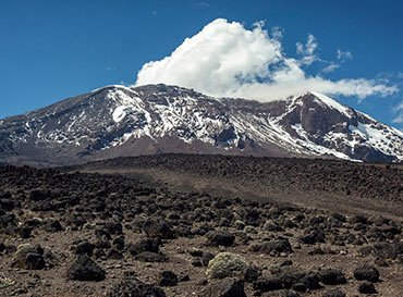
RONGAI ROUTE - KILIMANJARO TREKING
Budget
TBA
Per Person
Duration
6 Days
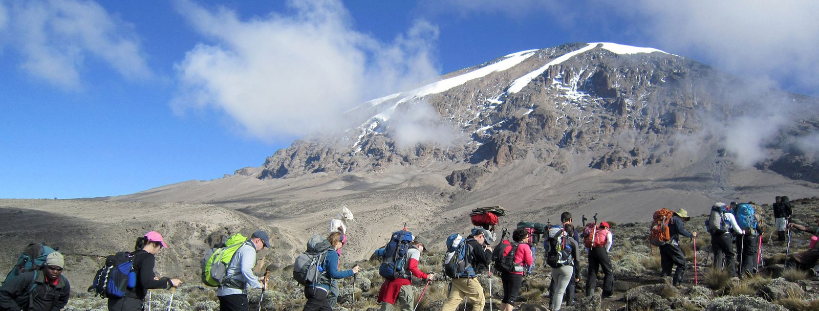
The Rongai route ascends Kilimanjaro from the north-eastern side of the mountain, along the border between Tanzania and Kenya. This route retains a sense of unspoilt wilderness and offers a different perspective on Kilimanjaro by approaching it from the north.The topography of the route does not allow for the application of the climb high and sleep low principle and hikers generally suffer more from altitude sickness on the Rongai route compared to other routes (an additional acclimatization day is highly recommended on this route). The Rongai route use the scree summiting path from Kibo hut to Gilman’s point and descend via the Marangu route.The main itinerary difference between the Rongai 6 day and 7 day routes is the additional acclimatization day at Mwenzi Tarn. .
Book This TripPackage Price Includes
- Return transfers from Arusha to the mountain
- Oxygen cylinder on the mountain
- All Park fees and crater fee
- Kilimanjaro hut fees
- All camping fees on safari
- Professional & experienced mountain guides
- Adequate porters to carry the entire luggage
- All meals while on the mountain and safari
- Professional cook on the mountain and safari
- Camping kitchen catering on safari and mountain.
- Unlimited clean purified drinking water on the mountain (you can also bring your purification pills)
- Mountain rescue fee
Price Does Not Include
- Accommodation before and after the climb
- Personal travel insurance, visas, and vaccinations.
- Any increase in government taxes that occur prior to the start of your trip.
- Cost of any client-requested itinerary modifications while the tour is in progress.
- Any expenses of a personal nature such as extra beverages, laundry, etc.
- Gratuity for your safari guide, cook and mountain crew (at your discretion).
- Mountain personal gears
Essential trip information
TRIP Inclusions
Want an in-depth insight into this trip? Essential Trip Information provides a detailed itinerary, visa info, how to get to your hotel, what's included - pretty much everything you need to know about this adventure and more.
Accomodation
Sleep (5 nights)
Meals
6 breakfasts, 6 lunches, 5 dinners
Transport
Treking
Trip Itinerire
We'll be there, like we've been there before
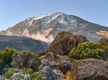
Depart from Moshi town and drive 45 minutes to the Marangu park gate for registration. From Marangu park gate we travel to Naro Moru, north east Kilimanjaro, a further 68km and approximately 2 ½ hours on bad roads to the Rongai start point (1996m). Meet your guide and porters before you begin your hike from the Nale Moru village. The small winding path crosses maize fields before entering pine forest, and then climbs gently through a forest. The trail is not at all steep, but is rather a gentle hike through a beautiful country side. The first night’s camp is at Simba Camp (2 626m). The camp facilities include a public toilet and a wooden table with benches, but no hut
- Hiking Time: 4 hours
- Distance: Approximately 6.7 km
- Habitat: Forest (Montane)
We hike from Simba camp up towards Kibo till 3 482m for lunch at First Caves, a distance of 5.8km. After lunch we continue trekking until reaching Kikelewa Camp at about 3679 metres. The views start to open up and you begin to feel you’re on a really big mountain! Water can be found in a obvious stream below the cave, although you might have to wander downhill a way to find a pool or two. Enjoy dinner and overnight at Kikelewa camp.
- Hiking Time: 6 – 7 hours
- Distance: Approximately 11.8 km
- Habitat: Moorlands
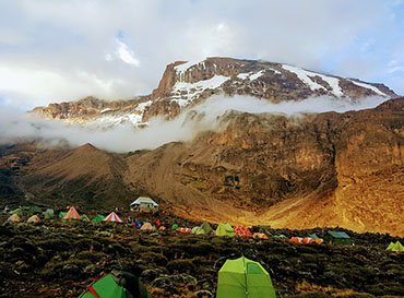
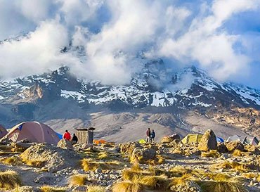
A short but steep climb up grassy slopes offers superb views of this wilderness area. The vegetation zone ends shortly before you reach your next camp at Mawenzi Tarn spectacularly situated beneath the towering spires of Mawenzi. Spend the afternoon acclimatizing and exploring the area.
- Hiking Time: 3 hours
- Distance: Approximately 3.7 km
- Habitat: Moorlands
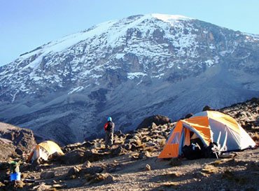
After breakfast we head west and continue ascending on the east side of Kibo crossing the saddle between Mawenzi and Kibo taking 4 to 5 hours to reach Kibo Hut. The remainder of the day is spent resting in preparation for the final ascent, which begins around midnight. Overnight at Kibo hut.
- Hiking Time: 5 hours
- Distance: Approximately 9 km
- Habitat: Alpine desert
You will rise around 23h20, and after some tea and biscuits you shuffle off into the night, and this is where the going really gets tough. The first section of the trail consists of a rocky path to the Hans Meyer Cave (5150m), also a good resting spot. The path then zigzags up to Gillman’s point (5 681m), which is located on the crater rim. This section is very steep with a lot of stone scree, requiring a great physical and mental effort. This is probably the most demanding section of the entire route. Do the Kili shuffle and move slowly. From Gillmans Point you will normally encounter snow all the way up to Uhuru peak (5895m), the highest point in Africa.
Total exhilaration and satisfaction – you made it
Weather conditions on the summit will determine how long you will be able to spend, taking photographs, before the 3 hour descent back to Kibo hut. After a short rest at Kibo hot, you gather all your gear you left behind for the ascent and head down to Horombo hut (3 hours) for your overnight. The return to Horombo hut will seem surprisingly fast compared to the ascent. The total time spent walking on this day is around 14 hours, so be prepared for a very tough day. Later in the evening you enjoy your last dinner (with soft drinks and beer for sale at the camp office) on the mountain and a well-earned sleep, filled with memories and stirring emotions.- Hiking Time: 7 to 8 hours to reach Uhuru Peak, 6 to 8 hours to descend to Horombo
- Distance: Approximately 5.4 km ascent and 15 km descent
- Habitat: Stone scree / ice-cap summit
By the morning of the sixth day you should have your appetite back and can enjoy your last breakfast on the mountain before heading down through the thick undergrowth of the lower slopes. Your knees may be very sore so go slowly and make sure of each footing as you descend to Mweka Gate. On arrival at the gate you will sign-out with the authorities and be presented with your summit certificate. At this point it is customary to present your porters and guides with their tips, before being transported back to your hotel in Moshi or Arusha.
- Hiking Time: 6 hours
- Distance: Approximately 19.7 km
- Habitat: Moorland & Montane Forest
SIMILAR TRIPS
You May Also Enjoy Our Other Trips

Our Partners
We team up with the best to give you an unmatchable experience


© 2025 All rights reserved.